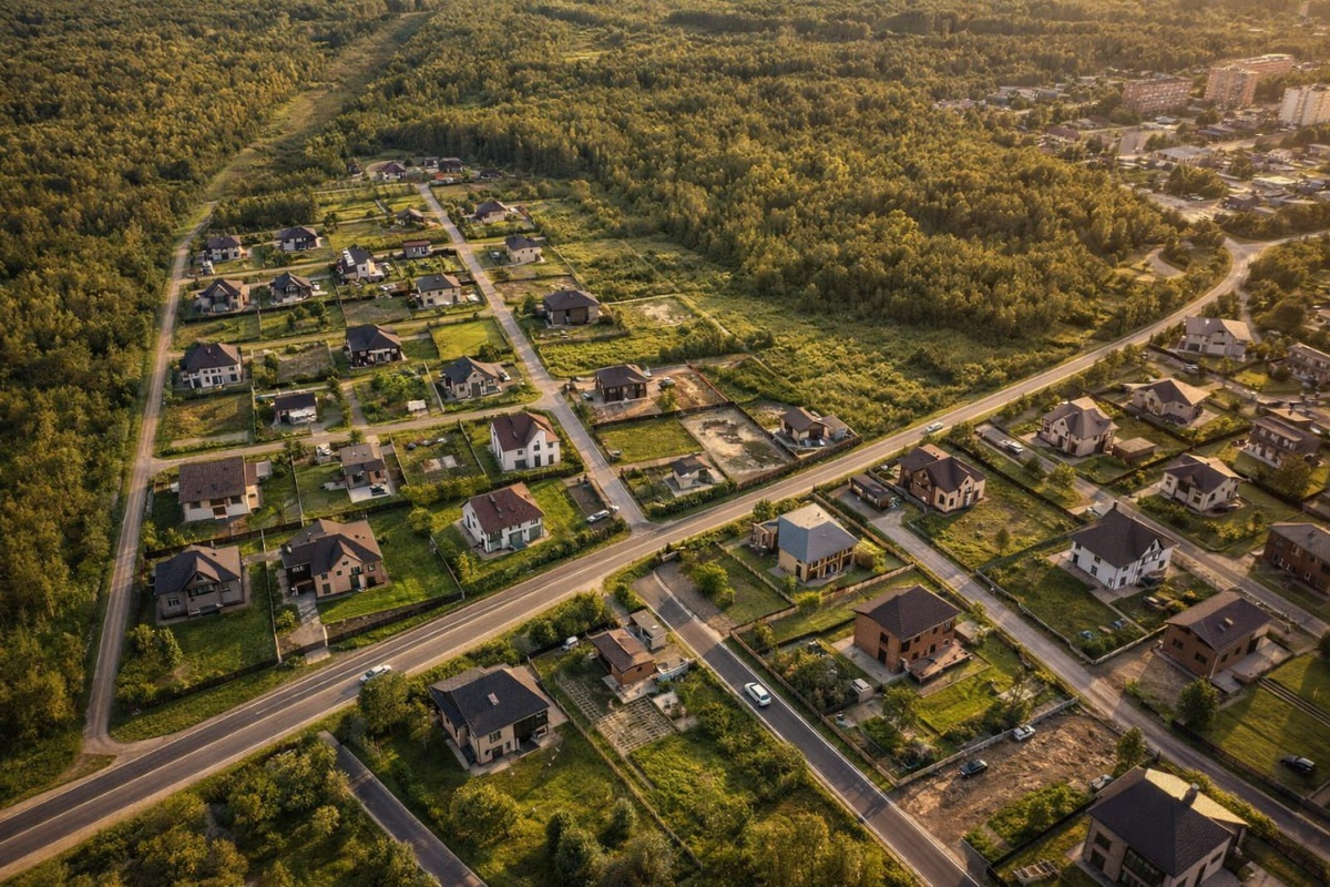
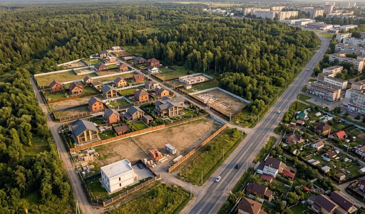
Нейросети и карта = вид с дрона
Тестируем разные нейросети с одним и тем же промтом и смотрим какие результаты получаются.
На фото исходник и результат от Нано банана и чатГПТ
промт тут:
Transform this satellite map into a realistic aerial drone photograph of a modern cottage поселок development.
Use the map as a strict base reference — preserve all roads, plot layout, and boundaries exactly as they are.
Convert the area into a clean, organized residential community:
– Add modern houses (mix of styles: frame, brick, aerated concrete)
– Show partially built development (some plots empty, some with houses)
– Add green lawns, fences, trees, and internal roads in good condition
Surroundings:
– Keep the forest area dense and natural
– Show nearby town buildings in the distance (as in original map)
– Keep the main road visible and realistic
Perspective:
– angled drone shot (45 degrees), not top-down
– height ~80–120 meters
Lighting:
– warm sunlight (late afternoon / golden hour)
– soft shadows, depth, realistic atmosphere
Style:
– photorealistic, cinematic, high detail
– premium land development presentation
– 4K, ultra realistic textures
Important:
– do not distort geometry
– keep accurate proportions of plots and roads
П.С. Промт что выше писал чатГПТ с моих слов)
Как думает какое изображение от Нано бана а какое от чат ГПТ (1-с многоэтажками, 2- без многоэтажек), пишите цифру и название нейросети в комментариях.