NORTHERN ARCTIC OCEAN (on Russian maps from the 17th century there are names: Arctic metro, Northern ok., Northern, or Arctic, metro, Arctic ok.), Part of the World ok., The smallest and smallest of the Earth’s oceans, located all in. polar region. It occupies the polar space between Eurasia and the North. America. It is characterized by partial surface coating with sea ice throughout the year. First highlighted as stand alone. ocean at 1650 netherlands. cartographer B. Varenius under the name. Hyperborean approx., In 1845 London geographic. named after S. L. about .; in the USSR, this name was officially adopted in 1935.
Physico-geographical sketch
S. L. about. well isolated from other regions of the World ok., communicates with the Pacific ok. through the narrow and shallow Bering Strait, the border runs parallel to Cape Unikyn (Chukotka Peninsula) to the intersection with the coast of Seward Peninsula (Alaska); with the Atlantic approx. - through the straits of Davis, Danish, Faroe-Icelandic, Faroe-Shetland, the border - east. the entrance to the Hudson Strait, along a parallel of 70 ° C. w. and further south. the outskirts of the Greenland and Norwegian seas. Pl. 14.75 million km2, volume 18.07 million km3 (about 4% of the world’s area, 1.35% of its volume), cf. the depth is 1225 m, the greatest - 5527 m (in the north-east part of the Greenland m.). The shallow shelf zone of the ocean (depths up to 200 m) occupies 39.6% of its area (compare the value for the World approx. 7.3%).
Seas
By physical geography. features and hydrological. regime within S. L. about. distinguish: North-European basin (S.-E. B.) - the Greenland, Norwegian, Barents and White seas; The Arctic basin (A. b.) Is a deep-water center. part S. L. about. and the seas are Asian. and amer. continental shoals - Kara, Laptev, East Siberian, Chukchi, Beaufort, Baffin, Lincoln, Hudson Hall. A. b. is divided by the underwater Lomonosov Ridge into sub-basins: Eurasian (E. s.) and Amerasian (A. s.). Some geographers distinguish as the Canadian Arctic basin (the seas of the Canadian Arctic archipelago - Baffin M., Lincoln M. and Hudson Bay), and the Norwegian and Greenland Seas are sometimes distinguished as the Norwegian-Greenland Basin (N.-G. B.), some foreign geographers do not include S.L. Norwegian Sea. Seas, bays and straits occupy b. h. area S. L. about. - almost 70% (10.28 million km2); on the seas washing the coast of Russia, accounts for St. 50% of their area.
The islands
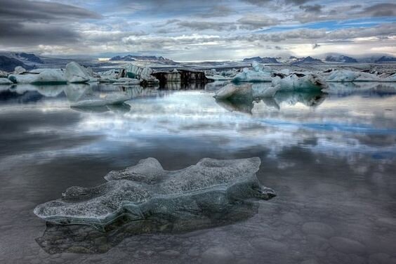
By the number of islands, S. L. Lake is, according to some estimates, ranked 2nd after the Pacific ok. The total area of the islands is approx. 4 million km2. It counts approx. 250 islands with an area of more than 100 km2. They are located preim. on the mainland shallows and are of mainland origin. The largest are Greenland (the largest in the world approx.), Iceland (on the border with the Atlantic approx.), Wrangel Island; Among the archipelagos are the Canadian Arctic Archipelago, Novaya Zemlya, Svalbard, Novosibirsk Islands, Severnaya Zemlya, Franz Josef Zemlya and others. Most of the Arctic. islands and archipelagos are covered with glaciers. In modern conditions. climate warming marked a decrease in arctic area. glaciers that are sources of icebergs.
The coast
In Scandinavia, Iceland and Greenland, pre. high, fjord shores; near the White, Barents and Kara Seas - abrasive, rugged by bays, partially low, even, in some places deltas. In the area of the Laptev, East Siberian, Chukchi and Beaufort seas, delta sites, lagoon places, in the Canadian Arctic archipelago - predominantly. low, even. DOS causes of coastline changes are frosty weathering, pestilence. abrasion, thermoabrasion (destruction rates of thermoabrasive shores in the Laptev metro reach 12 m per year). The influence of floating pestilence. ice formation on the coastline is assessed as weak.
Bottom relief
S. L. about. differs from other oceans in smaller depths and a highly developed shelf, occupying half of its area. The outer boundary of the shelf is located in cf. at depths of approx. 200 m (sometimes up to 500 m or more). Arctic Width shelf from 500 to 1200 km; all. b. shelves are relatively narrow - from 50 to 300 km.
Ch. a structural element of the bottom topography in A. s. there is an extensive Canadian basin with a fairly flat bottom with depths of up to 3900 m, surrounded by the Beaufort, Chukotsky uplifts and the Alpha and Mendeleev ridges, connecting to the shallow Siberian shelf; between the ranges of Alpha, Mendeleev and Lomonosov, crossing S. L. about. through the polar region (minimum depth less than 1000 m), the Makarov hollows (maximum depth 4030 m) and Podvodnikov are located; on the other side of the Lomonosov Ridge in E. s. 2 oblong basins are located (Amundsen - max. depth 4485 m and Nansen - 3975 m), separated by the Gakkel ridge, extending from the st. Frama (between the island of Greenland and the Svalbard archipelago) and the coast of Greenland in the general direction from west to east; all. b., separated in the south from the Atlantic approx. a chain of underwater rapids, 2 zones stand out - relatively small